Saturday, August 31, 2013

Day 19 - Ouray, CO (Day 1)

Today had all the symptoms of a typical Labor Day weekend.  It started slow and picked up from there.

The route:
101 miles - west on US-50 from Gunnison to Montrose, then south on US-550 to Ouray.

Morning Observations:
The morning drive on US-50 was pleasant.  Traffic was light.  Even the steep pull over Cerro Summit didn't seem to be a problem.  
Passing Blue Mesa Reservoir on US-50
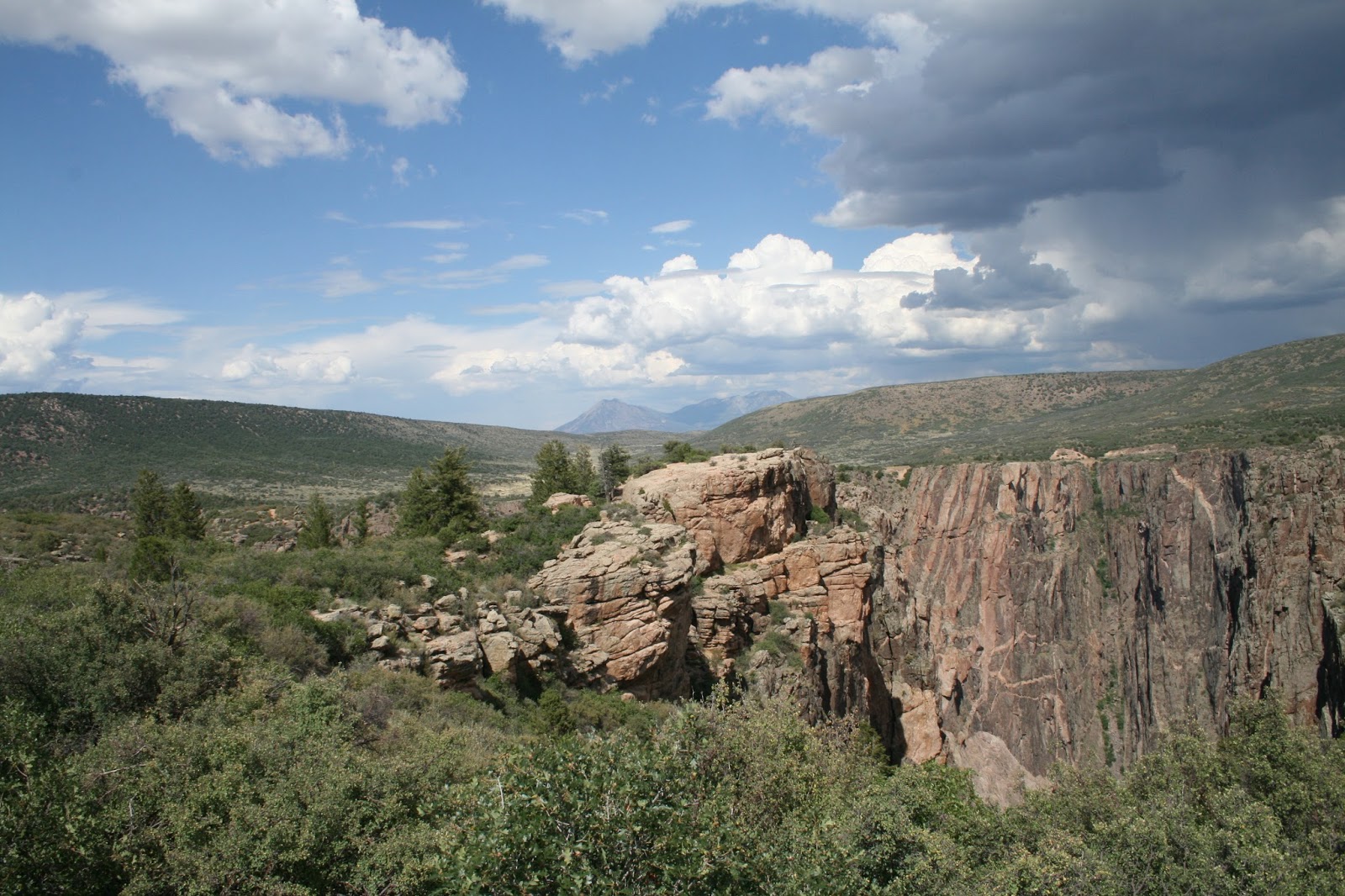
Approaching Black Canyon on US-50
Montrose:
We stopped in Montrose for some groceries, had lunch and filled the gas tank.  We were back on the road by 2:30pm.

Afternoon Observations:
There was a lot more traffic on US-550.  Storm clouds were beginning to form as we headed toward Mt. Sneffels (think Telluride).
South on US-550
Approaching Ouray

Campground:
We're staying at the Ouray KOA Campground for the next three days.  This is our holiday weekend reservation spot.  The place is sold-out (except for a few tent spaces) as expected.

The sites are small, but all are tucked in among trees.
Site #5
We have a nice picnic area
An Amish family is camped next to us.  They're from Arkansas.  They've squeezed a trailer, a pickup, two tents, a jeep and 7 bikes into their site.  They're heading home tomorrow.


Friday, August 30, 2013

Day 18 - Gunnison, CO (Day 2)

Thanks to Brooke Ash, we had a wonderful day exploring Black Canyon of the Gunnison National Park.  Brooke arrived at 9:30 and we headed west on US-50 toward Montrose.  

We passed Blue Mesa Reservoir, viewed the canyon from the north rim, viewed Morrow Point Dam, drove to Montrose for lunch, then returned to the park to view the canyon from the south rim.

Blue Mesa Reservoir:
Created by the Blue Mesa Dam, the Blue Mesa Reservoir is 20 miles long and has 96 miles of shoreline. It's the largest body of water entirely in Colorado.
Dillon Pinnacles at
Blue Mesa Reservoir
Returning to Gunnison on US-50
Blue Mesa Reservoir
Blue Mesa Dam

Black Canyon of the Gunnison:
The canyon was named "Black" because it's so deep, so sheer and so narrow that very little sunlight can penetrate it.  Only its rims, never the gorge, show evidence of human occupation.  The canyon became a national park in 1999.

North Rim:
We got to Pioneer Point Overlook by taking Black Canyon Road off CO-92 just west of Blue Mesa Dam.  Views from the north rim were awesome!
The Curecanti Needle
(center of picture)
An NPS crew was constructing
an overlook deck

There's more to see out here than mountains, rocks, canyons and rivers.
Brooke - a wonderful tour guide and friend
scrub brush and sage
A bit of color brightened the day
we saw this in Montrose

Morrow Point Dam:
This viewing was just a brief diversion from our drive to Montrose.
Entrance road with snow poles
It gets a little curvy down here
Morrow Point Dam
The Gunnison River flows on

Montrose:
US-50 continues west to Montrose.  It's the same route we'll take tomorrow as we travel to Ouray.  It won't be a casual drive.  There's a long steep pull over Cerro Summit (7,958 ft.) and the road is under construction for about 6 miles of the climb.
We descend more than 2,100 ft.
to arrive at Montrose

The city is very attractive.  Homes and businesses are well maintained.  The area looked prosperous.

Brooke recommended a local restaurant called Camp Robber.  It was a great choice.  Our lunches were delicious and the service was outstanding.

We enjoyed an unplanned tour of a new housing development as we tried to find our way back to US-50.  Oh well, it was fun and brought a few laughs.

South Rim:
The road to the park entrance for South Rim viewing (CO-347) is about 8 miles east of Montrose on US-50.
Tomichi Point
Peregrine Falcons soar over the canyon
Cross Fissures  View
This is an Open Range
This fellow and about 6 others proved it

A Final Treat:
We went into Gunnison tonight looking for a light dinner.  There were no strict rules, just find a place where we could get some soup and dessert.  We walked N. Main St. checking various menus for a while and finally settled on The Gunnisack.  Customers were waiting on benches outside.  We opted to eat at the bar and got seated right away.  That's when we realized we picked a winner.

Jillian (the bartender) served us and did a great job.  Another woman working beside the bar offered suggestions and chatted with us occasionally as we ate.  She turned out to be an owner, Lisa Jacobson.  She and her husband Dave started the restaurant in 2004.

We really enjoyed meeting Lisa and we think she enjoyed us because we raved about the meals.  

The Snickerdoodle Cookie dessert was exceptional.  It's baked to order and comes in three varieties.  Jillian would only let us order one to share.

The place was full and customers were waiting outside when we left.  We now know why.

Thursday, August 29, 2013

Day 17 - Gunnison, CO (Day 1)

We're heading into Labor Day Weekend.  Since our normal practice of travelling without advance reservations gets tested during major holidays, we did call ahead for the next few days.  We'll be in Gunnison today and tomorrow ... no advance reservations were needed. We'll be in Ouray from Saturday through Monday ... they required a 3-day minimum for the holiday weekend.  There should be plenty of availability for the rest of the trip.

The 122 mile drive from Leadville to Gunnison presented many beautiful scenes.  It included a hard pull (long grades of up to 7%) over 11,312 foot Monarch Pass.

The route:
US-24E from Leadville to US-285 at Buena Vista, south on US-285 to Poncha Springs, then US-50W to Gunnison.

Along the way:
Goodbye to Sugar Loafin' RV Campground
(It was a nice, rustic place to stay)
View of Mt. Elbert and the Arkansas River Valley
as we pull out of the campground
There are lots of farms and ranches
as we drive south on US-24
Continuing south on US-24
Heading east on US-50
Entrance to Monarch Mountain Ski Resort
(On US-50, near the summit)
Monarch Mountain ski lift
We followed this Airstream from Wisconsin
down the west slope of the pass
It's a long, steep grade down
US-50 approaching Gunnison
We see many abandoned ranches and cabins
(It's exciting to imagine their history)

Gunnison:
Our route to the campground took us through downtown Gunnison on US-50 (Tomichi Avenue).  It provided an impressive view of a small, clean, modern city.  The streets are really wide ... even the side streets.  We were able to do a u-turn with plenty of room to spare on a side street, with the trailer attached.

We stopped for a late lunch at El Paraiso Family Mexican Restaurant.  The facility, the service and the meal were excellent.

Campground:
Mesa RV Resort is 4 miles west of Gunnison.  The campground and is very nice, affordable and even has green grass.  It's operated by pleasant, young couple.  
Site #19
We got here early enough for today to become "laundry day".  Carol was pleased with the cost and operation of the washers ($1.25 per load) and dryers ($0.50 per load).  That's quite a value when compared to other campgrounds.

FYI:
Gunnison has consecutive winter days that get down to -40°F.  Today reached 81°F.  It's obvious we came at the right time.

We've been using a smartphone weather application (WCMH WX) that we like a lot.  Thanks Amy!

Tomorrow:
We're going to see Black Canyon of the Gunnison with Brooke Ash.  Brooke lives in Gunnison and is Barbara's (Carol's daughter) best friend.

Wednesday, August 28, 2013

Day 16 - Leadville, CO (Day 3)

This will be our last day in Leadville, so we spent it with more exploring.

Tabor Opera House:
The opera house was built in 1879 by Horace Tabor, one of Colorado's most well known mining magnates.  Construction was completed 100 days from the groundbreaking.
Tour Guide
Inside the Box Office
Slotted boards were used to keep track of sold seats
Nice seating
Box seats were placed on both sides
Under the stage
Leading lady's dressing room
Under the stage
Leading man's dressing room
The stage
There was seating for 880
This act emptied the house
Stairs to the balcony
Balcony view

They said "If it plays on Broadway, it plays at the Tabor Opera House".  Big names played on this stage including: Houdini, John Phillip Sousa, Oscar Wilde, Anna Held and even The Unsinkable Molly Brown.


National Mining Hall of Fame & Museum:
Leadville has experienced mining booms with Gold, Silver, Zinc, Lead, Copper and Molybdenum (the locals call it Molly).  We went to the museum to find out how this happened.

Mining's colorful history is wonderfully displayed throughout the facility.  We left with a greater appreciation for how mining has enriched our lives.  We were constantly reminded that "Everything starts with mining.  Everything!!!"
Flowers outside the museum
Matchless Mine:
Horace Tabor and his wife Baby Doe Tabor made millions from their Matchless Mine. Unfortunately, Horace died nearly penniless and Baby Doe died 35 years later as a pauper trying to regain their lost wealth.
Baby Doe's cabin (foreground)
Matchless Mine (background)
Hoist
(shaft is about 500 feet deep)
1 ton ore car
Tour guide Dennis explains how the
ore gets to the smelter
ore bucket
(miners would often hitch a ride in the bucket)
steam powered winch
Carol takes us on a tour of
Baby Doe's cabin
north wall at entrance
east wall picture gallery
Baby Doe was Horace's 2nd wife
southeast corner
south wall, looking east
After living in years of opulence,
Baby Doe died of a heart attack, alone, in this cabin
More Homes:
We saw a few more homes of interest as we drove around the town.
More Victorian homes
Horace Tabor's home on E. 5th 
(He had others that were much larger)
A miner's cabin,
obviously not of Victorian style
Mt. Elbert:
At 14, 433 feet, Mt. Elbert is the highest peak in the Rocky Mountains of North America and the second-highest mountain in the contiguous United States.

Tomorrow:
We're heading for Gunnison tomorrow.